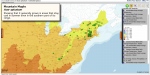
 The USGS Biodiversity Information Serving Our Nation (BISON – http://bison.usgs.ornl.gov/) online mapping application has added just over two hundred thousand species occurrence records for keystone pollinators–native bees. This native bee species occurrences dataset from the USGS Patuxent Wildlife Research Center’s Native Bee Inventory and Monitoring Lab (lead by Sam Droege) is just one of a series of USGS science center datasets including bird and bat species occurrence datasets that are currently being processed for public release and download through BISON. Once included in BISON, they can be integrated with other prominent species occurrence datasets from sources such as the United States Department of Agriculture’s (USDA) PLANTS database, the Illinois Natural History Survey, the University of Kansas Biodiversity Institute’s Snow Entomological Museum Collection, and the USDA Agricultural Research Service’s (ARS) Bee Biology and Systematics Laboratory, among other participating BISON and GBIF Data Providers. An additional 53 map layers are also available in the online map viewer; and various Developer Tools and Application Programming Interfaces (API) or Web Services capabilities are also available for tool development and more direct access to the data. The USGS Biodiversity Information Serving Our Nation (BISON – http://bison.usgs.ornl.gov/) online mapping application has added just over two hundred thousand species occurrence records for keystone pollinators–native bees. This native bee species occurrences dataset from the USGS Patuxent Wildlife Research Center’s Native Bee Inventory and Monitoring Lab (lead by Sam Droege) is just one of a series of USGS science center datasets including bird and bat species occurrence datasets that are currently being processed for public release and download through BISON. Once included in BISON, they can be integrated with other prominent species occurrence datasets from sources such as the United States Department of Agriculture’s (USDA) PLANTS database, the Illinois Natural History Survey, the University of Kansas Biodiversity Institute’s Snow Entomological Museum Collection, and the USDA Agricultural Research Service’s (ARS) Bee Biology and Systematics Laboratory, among other participating BISON and GBIF Data Providers. An additional 53 map layers are also available in the online map viewer; and various Developer Tools and Application Programming Interfaces (API) or Web Services capabilities are also available for tool development and more direct access to the data.
A product of the USGS Core Science Analytics, Synthesis, and Libraries (CSAS&L) Program, BISON is an information system that allows users to access, explore, and download U.S. species occurrence data from participating BISON and GBIF Data Providers. Researchers collect species occurrence data, records of an organism at a particular time in a particular place, as a primary or ancillary function of many biological field investigations. Presently, these data reside in numerous distributed systems and formats (including publications) and are consequently not being used to their full potential. As a step toward addressing this challenge, the USGS is developing BISON as an integrated and permanent resource for biological occurrence data from the United States. BISON will leverage the accumulated human infrastructural resources of the long-term USGS investment in research and information management and delivery. USGS is also the U.S. Node of the Global Biodiversity Information Facility (GBIF), an international, government-initiated and funded effort focused on making biodiversity data freely available for scientific research, conservation, and sustainable development. USGS, with its partners at the Department of Energy's Oak Ridge National Laboratory (ORNL), hosts a full mirror of the hundreds of millions of global records to which GBIF provides access. BISON was initiated with the 110 million records GBIF makes available from the U.S. and is integrating millions more records from other sources each year.
Please send any comments, questions, errors or bugs encountered to bison@usgs.gov.
See Attached files here:
|
 news
news Print view